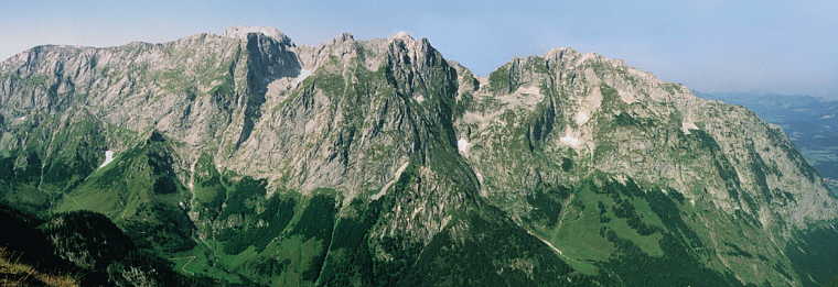
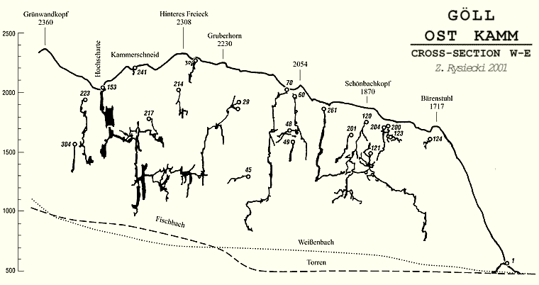
The structure of the massif is complex, with many faults. The major drainage
routes at the level of the present-day erosional base run parallel to
the surrounding valleys; the major part of groundwater emerges in the
Schwarzbachfall resurgence at the altitude of 560 m. The discharge at
high water season is 0.5 m3/s.
The area is very interesting because of its geological and tectonic setting.
The position near the northern edge of the Salzburger Alps plate and the
transmission of uplift-related stress created an interesting tectonic
system. This narrow ridge, arranged perpendicular to the master valley
is cut by a thrust plane at an acute angle.
This provides for the great differences in the effects of karstic phenomena
between the southern and the northern part of the area. The progress of
relief-forming processes and lowering of the erosional base result in
shifting with time of the resurgence zones from the south around the massif
- to the east and north. Tracing and correlation of the effects of evolution
of karst phenomena in an area where rock masses with markedly differing
dips of strata are juxtaposed provides an exceptional opportunity for
observations that document the course of the relief-forming karst processes.
|
The Göll massif seen from the
South, ph. Pawe³ Krzyszkowski
|

|